
 |
 |
 |
 |
 |
 |
 |
 |

Members of
 |
Slea Head Drive: Stops, Timing and Driving Tips
Slea Head Drive is a circular route around the western tip of the Dingle Peninsula in County Kerry, Ireland. It is commonly described as roughly 47 kilometres (about 30 miles) long, starting and finishing in Dingle town, and it forms part of the Wild Atlantic Way. Without stops the drive takes a few hours; with the stops listed here, most people need a half day, and many take longer. This page covers the stops in order, timing and what to expect on the road.
The route in brief
From Dingle (An Daingean), the loop heads west through Ventry (Ceann Trá), past Dunbeg, round the headland near Slea Head itself, through Dunquin (Dún Chaoin) and Ballyferriter, then back east past Gallarus. Many visitors do it as a loop from Dingle, but you can treat the route in sections and break it up.
Signposts in this part of Ireland are often bilingual, and the area is a Gaeltacht, an Irish-speaking region. Place names on signs may appear in Irish only, so a map or satnav helps.
Stops along the way, in order
Ventry
A wide beach on the south side of the peninsula. It is a good place for a first stop, with space to park and look back across the bay.
Dunbeg Fort
Dún Beag is a promontory fort on the cliff edge, usually dated to the Iron Age. Part of it has been lost to coastal erosion over time. Pay attention to signs about access and cliff safety.
Beehive huts
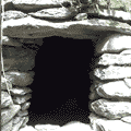
Clusters of drystone clochán, shaped like upturned bowls, sit on the hillside near the road. Their age is uncertain and debated, and some are much more recent than others. For a closer explanation of how they were built and what scholars say about them, read the article on the beehive huts of the Dingle Peninsula. Access to some sites is through private land and may carry a small fee, so look at signs on arrival.
Slea Head and the Blasket views
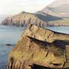
Near the point itself, the road runs along high ground with views of the Blasket Islands, which lie just off the coast. The Great Blasket was inhabited until the early 1950s, when the remaining islanders were resettled on the mainland. There are laybys, but the road is narrow, so pull in carefully and watch for walkers.
Coumeenoole Beach
A small, exposed cove below the road, known for its cliffs and Atlantic swell. The 1970 film Ryan’s Daughter was filmed in this area. Swimming is not advised here because of strong currents; treat it as a viewpoint.
Dunquin and the Blasket Centre
Dunquin has a small harbour and the Blasket Centre (Ionad an Bhlascaoid Mhóir), a heritage centre on the islands’ history, language and literature. Opening days and hours vary by season, so check the official source before planning a visit.
Gallarus and Kilmalkedar
On the return leg you reach the early Christian oratory at Gallarus and, nearby, the ruins of the church at Kilmalkedar. Both are part of the story of early medieval Christianity on the peninsula, and the guide to the route and its sights places them in the wider itinerary.
What to bring
Pack waterproofs even on a clear morning, sturdy shoes for wet grass and rocky paths, and a charged phone. Mobile signal can be patchy in the hills and coves, so download a map beforehand or carry a paper one. Bring water and snacks if you plan to be out for several hours, since cafés are spaced widely along the western stretch and may keep seasonal hours.
How long does it take?
| Plan | Time to allow |
|---|---|
| Driving only, no stops | A few hours |
| Main viewpoints and two or three short stops | Half a day |
| Heritage sites, a walk and a meal | A full day |
Roads, traffic and weather change these numbers. In summer, tour coaches slow the road, and narrow sections may need reversing to let vehicles pass. Starting early often gives quieter roads.
Driving tips
- Drive on the left. Ireland drives on the left, which matters if you come from a right-hand-traffic country.
- Allow for narrow roads. Many sections are single-lane in practice, with stone walls close on both sides.
- Check the direction. Tour coaches commonly follow a particular direction around the loop to avoid meeting head-on, and local advice may apply. Ask locally or look for signs.
- Use passing places. Pull in to let oncoming traffic pass. Do not stop on bends.
- Watch for sheep and walkers. They are common and unpredictable.
- Fuel up. There are few services on the western stretch, so fill up in Dingle.
- Weather. Atlantic weather can change quickly, and cliff paths become slippery in rain.
Seasons and light
Summer brings long evenings and the busiest roads. Spring and autumn are quieter, with changeable weather and shorter days, which affects how much you can fit in. In winter some attractions close or run reduced hours, so confirm before you travel. Sunset over the Blaskets is a popular sight, but allow enough time to return in daylight.
Alternatives to driving
Cycling the loop is possible for fit and confident riders, but the narrow roads and hills call for caution. Local bus tours also run in season, though timetables change, so ask locally. Walking selected sections of the route is another option.
Context: land, language and history
The peninsula’s landscape carries a long history, from prehistoric and early Christian remains to the era of the Great Famine, which hit west Kerry hard in the 1840s. The article on the Great Famine in West Kerry gives background on that period. Planning information on Irish tourism can be found at Ireland.com.
Frequently asked questions
How long is Slea Head Drive?
It is commonly quoted as around 47 kilometres (30 miles) as a loop from Dingle. The exact figure depends on where you start and whether you add detours.
Can you do Slea Head Drive in a day?
Yes. A half day suits a quick trip, and a full day allows time for sites, a walk and a meal.
Is the drive suitable for large vehicles?
Large vehicles and caravans find the narrow sections difficult. Check local advice and restrictions before attempting it in such a vehicle.
What is the best time of day to go?
Early morning or later in the afternoon tend to be quieter. Light for photography and weather conditions also vary, so be flexible.